Wednesday, 7 August 2013

In search of glacial sediment!

When we went and looked back through all the academic articles on Peak District Glaciation, we were amazed to find that diamicton (unsorted sediment with a wide range of clast sizes) had been widely observed by field scientists. Diamictons can be formed by a wide range of processes, including by ice sheets and glaciers, in which case they are referred to as 'tills'. Finding till in the Peak District would therefore be really good evidence of ice in the region, although we would still have to work out when it had been deposited. 


Striated rock shown to us by the caver!
First of all we visited a disused limestone quarry near to Eyam, where till had been previously reported. We were hoping to see a drape of till on top of the limestone. Unfortunately, despite scrabbling around for a good while we could not find any. Then Chris Clark suggested we visit an old caver he new in a nearby village, in an attempt to tap into some local knowledge. 

Chris' caver was extremely keen to help out. On walking into his house we were met by a veritable treasure trove of fossils and rocks, including one large rock covered in striations. Striations are small scratches, formed when rock fragments carried by the ice rub agains other rocks. This gave us hope that our mission would not be in vain; and indeed the gentleman pointed out several locations nearby where he had seen rocks like this - a sure indication of glacial activity!

In good spirits we headed into our second quarry, where immediately we discovered an absolutely massive section of diamicton, chock full of striated rocks and exotic rock-types (erratics), which must have been carried by the ice to this locality. We had found our till! 

Of course, now we are left with the age old question - when was the till deposited? On top of the till we identified a sequence of clays and silts, which are found at the bottom of lakes. Given that the lake sediments lie directly above the till, they were probably deposited in a lake dammed by the retreating ice. Crucially, we can date the lake sediments in a future visit to tell us when the ice had retreated. 

We therefore intend to return to the site later on in the summer to try and date the silts above the till, and also do further work on the till itself to try and decipher its depositional history (e.g. was it deposited under a glacier?).
Thick sequence of diamicton (note all the rocks jutting out), with silt and clay on top.


Wednesday, 17 July 2013

Modelling the Peak District Ice Cap


By studying the glacial 'footprint' of landforms and sediments imprinted on a landscape, it can be possible to make interpretations about how former ice sheets and glaciers flowed, how far they extended, and their dynamics (how they behaved over time). However, it becomes more difficult to reconstruct these ice masses where this geological evidence is sparse (such as here in the Peak District).

A computer simulated reconstruction of the British-Irish Ice Sheet at its maximum extent during the last ice age. Ice would have flowed from all major mountain areas towards the ice margins via a number of fast flowing streams of ice. The Peak District lay on the ice sheets southern margin, and so the exact degree of glacial influence in this area is still under debate.

An alternative method for reconstructing past glacial activity is to use a numerical model, i.e. producing a virtual simulation of the ice cover on a computer. These models are governed by equations, which define how ice accumulates, flows and melts, as well as environmental conditions that control climate change, sea level fluctuations, and crustal flexing as the weight of the ice presses down on it. Numerical modelling can therefore be a powerful tool for providing insights into how past ice sheets behaved through time, particularly so if modelled output can also be guided by geological evidence. 

Herein lies the problem in trying to simulate the 'Peak District Ice Cap'. Its sensitive position on the periphery of the main British-Irish Ice Sheet, small area, as well as a lack of evidence for its maximum extent and potential age, means we have little to go on.

By fortunate coincidence, a recent modelling study of the Welsh Ice Cap  by Henry Patton included the Peak District National Park within its study area. By using these reconstructions of the much larger and better constrained ice mass covering Wales to fix environmental conditions, we therefore have a guide to help us to model the Peak District glaciation with more confidence.

Results

Initial model experiments have so far indicated that there was probably significant ice cover over The Peaks for around 2,500 years during the last ice age. The Google Earth animation (at the end of this blog) shows one model run, from the ice cap's inception through to its maximum extent and subsequent melting.

Model output (ice thickness, surface velocity and percentage time warm-based) of the Peak District ice cap
Notably, the model predicts the ice cap to have been predominantly frozen to the underlying bedrock, and
also very slow-moving, with surface speeds no greater than 
40 m per year. Both these characteristics could help to explain the dearth of erosional landforms found in the Peak District. The model also suggests that the ice was relatively thin, reaching up to around 150 m thick over the hills, and 250 m thick within adjacent valleys.

These results offer a tantalizing prediction of an extensive, largely static and non-erosive 'Peak District Ice Cap' during the last glaciation of Britain. However, model outputs are only ever as good as the data used to constrain them. Whether these experiments offer a true picture of past glacial events will only be resolved through further detailed empirical data collection.

written by Henry Patton

Tuesday, 2 July 2013

Planning and initial recce

After a day spent leafing through old books and articles and looking at airborne imagery of the Peak District, we identified a number of interesting sites to go and look for evidence of glaciation.

Meltwater channels?

Brian Whalley and Darrel Swift walking down a possible meltwater channel on the moor above Shatton. In the foreground another channel runs parallel to the one they are walking down. 
On what was a glorious summer's day we met bright and early at the Department of Geography and, after a momentary hiccup getting one of the cars started, made our way up past Shatton to our first field site. Here we had identified a number of parallel channels which, rather than running straight down the hillside, as streams would, cut obliquely across it. This oblique orientation of the channels is common in glaciated regions, where meltwater runs along the sides of the glacier rather than down the slope. As the glacier then retreats, flights of parallel channels can develop down the slope. They are therefore a prime candidate for meltwater channels and would demonstrate the former existence of a glacier in the valley. However, a fierce debate quickly followed, between those claiming that these features were formed by meltwater running along the edge of a glacier, and those convinced that it was humans dragging rocks down to build their farmhouses and drystone walls. Professor Chris Clark explains the problem in this video below.  


To try and resolve this debate we moved further around the hillside to investigate some channel-like features that clearly were formed by farmers carting rocks from pits to build farmhouses and drystone walls. Although the features were similar in dimension to the potential meltwater channels we'd seen earlier, their association with stone pits and their straight nature gave us criteria with which to distinguish them from meltwater channels on future field trips. However, without more detailed field measurements, such as channel width, slope angle and whether they were formed in bedrock or sediment, we were unable to categorically demonstrate that the first channels we visited were formed by meltwater flowing along a glacier margin. 

Glacial sands and gravels on the top of Abney Moor?

After a bumpy ride in the back of one of Chris Clark's Legendary Land Rovers we reached our second site, at the top of Abney Moor, where sands and gravels associated with the last ice age had been previously reported in a geological memoir. We were particularly excited about this as glacial sands and gravels so high up (400 m) would mean a similar ice-surface elevation, and we could also date the sands to get an age on their formation. We spent a good deal of time trying to find these sands and gravels using a hand auger (tool used to bore a hole into the ground and collect a sample of the underlying sediment), but could only find a thick clay/silt unit overlain by peat. The significance of the site is explained by Dr Stephen Livingstone and the augering process demonstrated by Calvin Shackleton (with help from Jeremy Ely) in the video below.


Although we did not find any sands or gravels, despite the memoir, the clay unit does indicate a large lake in the area, which we hypothesised could not have formed without being dammed by ice. We decided that we would return to the area in the near future to take a core through the sediments, and to date the switch from lake to peat formation, by sampling the bottom of the peat unit.

On the walk back to Chris's farm for lunch we stopped to look at a couple of channel-forms identified from the airborne imagery. We were able to rule these out as candidates for meltwater channels, because their dimensions and surroundings were too similar to that produced by human activity (see previous section on meltwater channels).


Moraines at Glossop?


After admiring the animals and eating our sandwiches at Chris Clark's farm we headed off over the Snake Pass to look for evidence of moraines (ridges of sediment deposited by glaciers, often at their snout or along their sides). On the walk out Dr Darrel Swift spotted some erratics in a dry-stone wall (explained in the video below) that were likely to have been brought over by the main British-Ice Sheet, which infringed upon the western side of the Peak district around Glossop.

We were able to discount a number of ridges northeast of Glossop that seemed to be geologically controlled (i.e. due to differences in rock type). This was confirmed by the existence of old pits on the surface of one of the ridges, which would have been used to quarry bedrock (rather than glacial sediments). And similarly, some of the ridges that looked like moraines on the airborne imagery actually turned out to be landslide deposits upon closer inspection. With our spirits dampened somewhat by the lack of glacial features we headed back to the cars. But when we looked back at where we had just been, we identified what looked like a large moraine. We'd been standing on it!
A possible moraine northeast of Glossop. Ice-flow would have come from off the Peak District plateau out of shot to the right of the photo. The steep, arcuate slope on the right hand side of the ridge, its raised profile, and a number of small scars that seem to indicate that it is composed of sediment, together provide the best clues that it is a moraine deposited at the downstream margin of a glacier emanating from the Peak District. 

The day ended with a lengthy discussion in the pub where we evaluated  all the sites again, given the day's discoveries. We decided that there are tantalizing clues which seem to point towards a former glaciation, although the picture is muddied by post-glacial processes, and we still don't know how old the features are. A further recce of other possible sites is required; along with more detailed field measurements and collection of dateable material, to try to constrain the timing of formation of the features we've observed today.

Written by Calvin Shackleton and Stephen Livingstone

Was the Peak District glaciated?

Although the Geography Department of the University of Sheffield sits on the doorstep of the Peak District, we still do not really know whether this upland region was glaciated during the great ice ages of the past, and in particular the last ice age (c. 21,000 years ago), which covered much of the country. This seems absurd given the collected expertise of the Geography Department in looking at current and past ice-sheets! This blog records our efforts to solve the problem

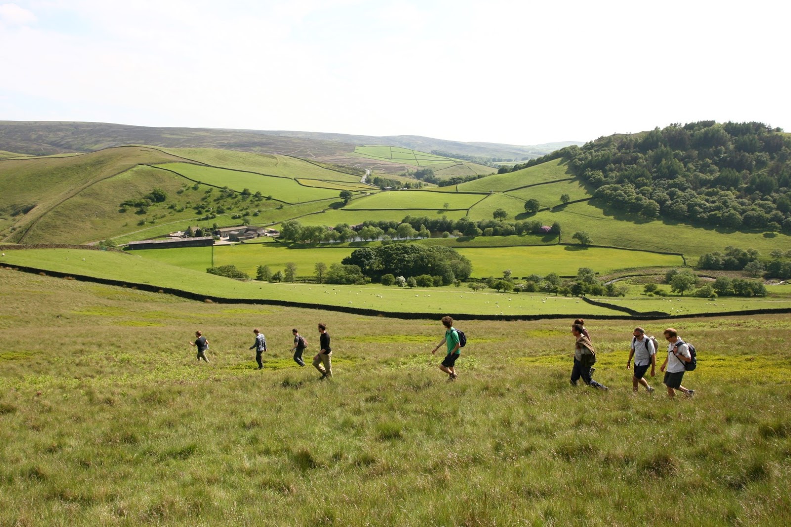
Walking over to investigate a possible moraine near Glossop
Currently, the Peak District is thought to lie just outside the limits of the last Glaciation. However, there is fragmentary evidence, principally found in the White Peaks, of glacial landforms and sediments. This notion stemmed from a seminal piece of research by Jowett and Charlesworth in 1929, who related these features to much older, more extensive glaciations. But without ages to tie the evidence to a particular ice age we cannot be sure. 
View up towards Whin Hill

Just looking up at the upland plateaus, which reach over 500 m, it is hard not to envisage snow collecting there, and an ice-cap forming. But finding evidence of an ice-cap can be a bit like looking for a needle in a haystack! This is because, as research in Norway, Iceland and Arctic Canada have neatly demonstrated, any ice-cap that might have formed is more likely to preserve, rather than modify, the underlying landscape because the ice would have been thin, slow-moving and cold. Often the only evidence of ice having existed is in the neighbouring valleys, where ice has spilled-off the plateaus forming small glaciers. Here ridges of sediment (morainecan be carried to the snout of the glacier, meltwater channels eroded along its sides, and the rock scratched and smoothed in the process.

The problem is complicated further in the Peak District, because the landscape has been heavily influenced by other processes. For instance, glacial landforms might have been buried by large landslides, which in turn can look very similar to moraine. The Peak District also has a long history of human activity, which has modified the landscape in its own ways. To take one example, as rock was carried from small pits to build drystone walls and farm buildings, it wore tracks in the ground that look remarkably similar to how we'd expect channels cut by meltwater to look.
So much for the problems; here's what we propose to do. During the course of this project we will be mapping Peak District landforms from airborne imagery; walking the region to double-check our conclusion; collecting samples to determine the age of the landforms; even running a computer simulation to see if we can reproduce the ice-cap from past climate conditions! We will record our successes - or otherwise - here, so stay tuned for further updates.

The team standing in a pit and looking down a sledge track used to build the farm in the near distance.